
These Are the Top 10 Secret Beaches in the West (Don’t Tell Anybody!)
Your guide to the West’s most spectacular secret beaches. Just don’t tell anyone you heard it here
Michael L. Bird/Getty Images
FACT: The number of bodies on a given patch of sand is directly proportional to the proximity and size of the closest parking lot. That means that if you don’t mind scrambling for parking or hiking a bit, you just might find yourself alone on a beautiful empty beach.
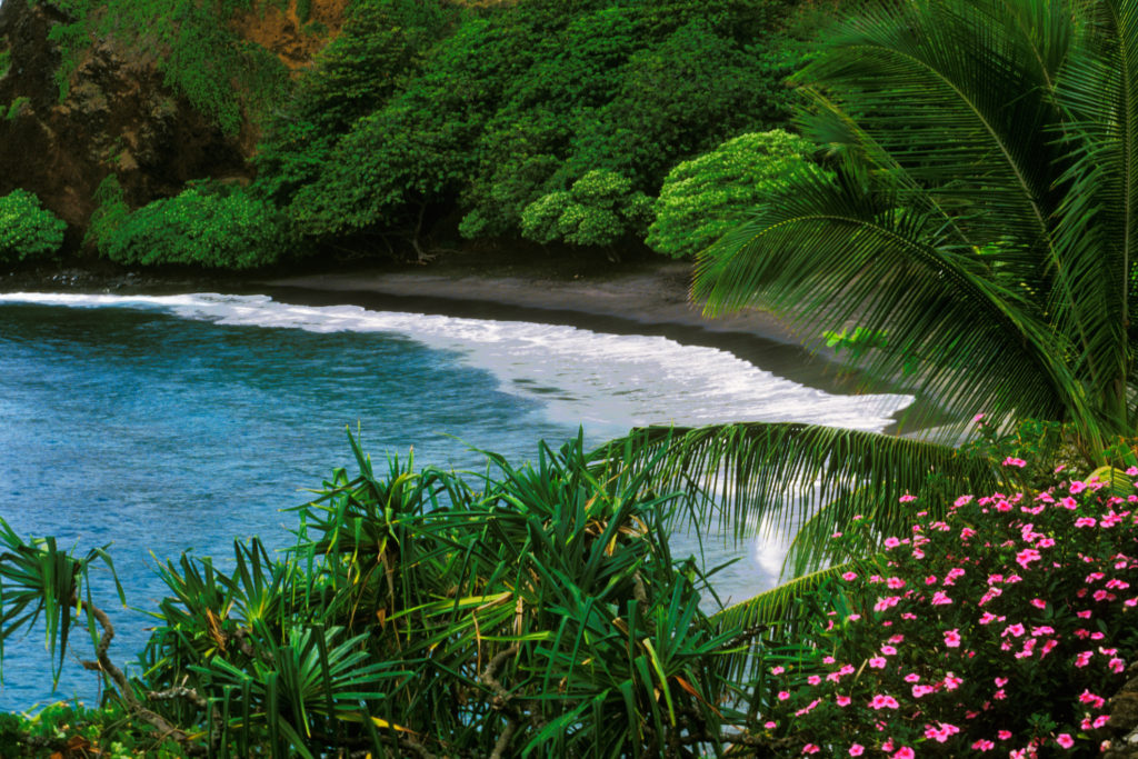
1. Hamoa Beach, Maui, Hawaii
Frank J. Wicker/Getty Images
Hala trees and swaying palms fringe a half-moon of salt-and-pepper sand, backed by black lava cliffs. In summer, the crashing waves calm down to make the water welcoming for beginning bodysurfers. The three-hour drive from the touristed southern shore keeps crowds at bay.
How to get there: About a mile past “downtown” Hana on the S. Hana Hwy., turn left onto Haneo’o Rd. —Lisa Trottier
2. Indian Beach, Seaside, Oregon
Thomas J. Story
More Videos From Sunset
At the end of a twisty road that winds through dense Sitka spruce forests in Ecola State Park, Indian Beach looks open and welcoming. The smooth, sandy, horseshoe-shaped beach is tucked into a cove and sheltered from wind, making it a perfect place for surfing or just staring at sea stacks.
How to get there: At the end of the paved road in Ecola State Park. —Lucy Burningham
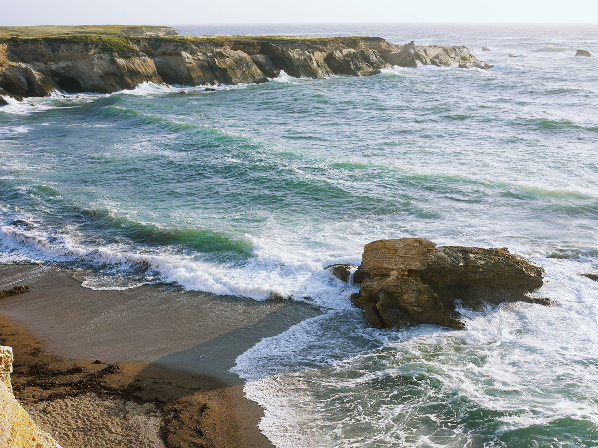
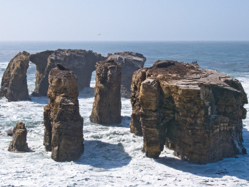
3. Salt Creek Recreation Area, Port Angeles, Washington
Tim Abramowitz/Getty Images
Sculpins, seastars, and oceanography students all frequent the tidepools at Tongue Point, but Salt Creek’s charms don’t end there. Climb a sea stack, fly a kite on the beach, photograph passing ships, or overnight at a blufftop campsite.
How to get there: From Port Angeles, take U.S. 101 west 5 miles; turn right on State 112 and go 7 miles; turn right on Camp Hayden Rd. and go 3½ miles to Salt Creek Recreation Area. INFO: Campsites; clallam.net. —Jim McCausland
4. Robert E. Badham Marine Conservation Area, Orange County, California
Lagunatic Photo/Getty Images
Better known as Little Corona, the petite, shy sister of hefty, popular Corona del Mar State Beach can be accessed only by those willing to look for street parking and then hike down (and back up) a lifeguard access road to a cove.
How to get there: Poppy Ave. at Ocean Blvd., Newport Beach. —David Lansing
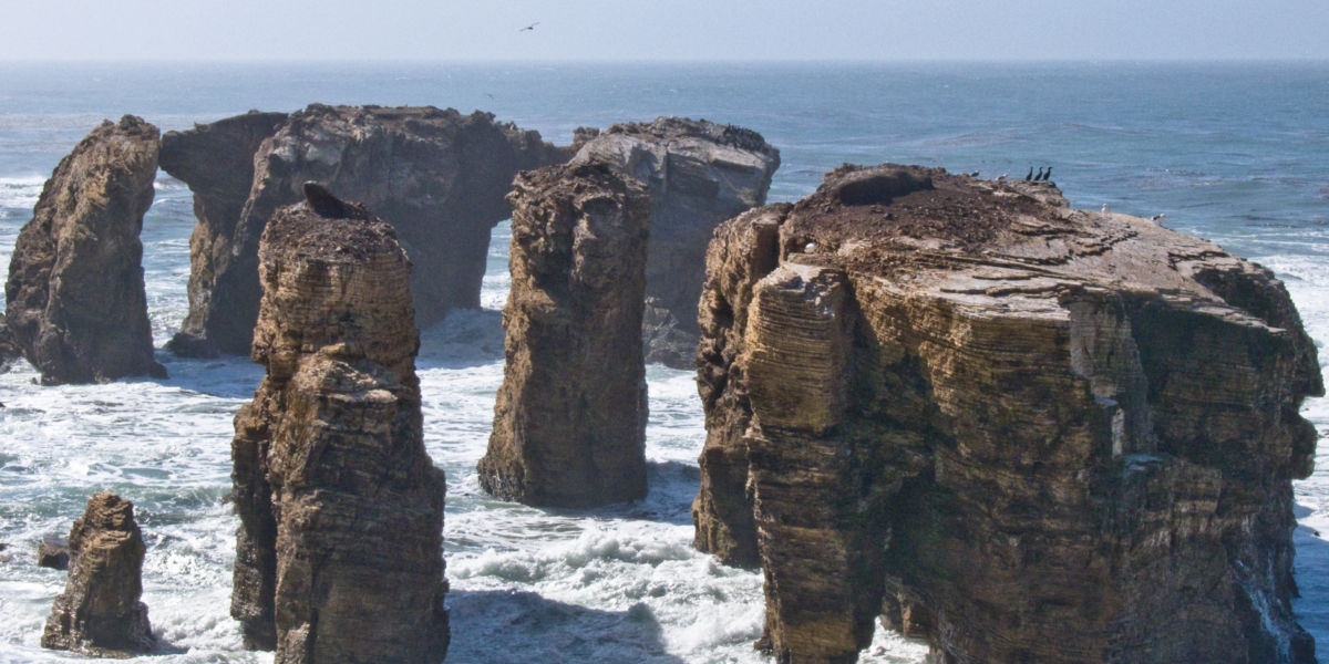
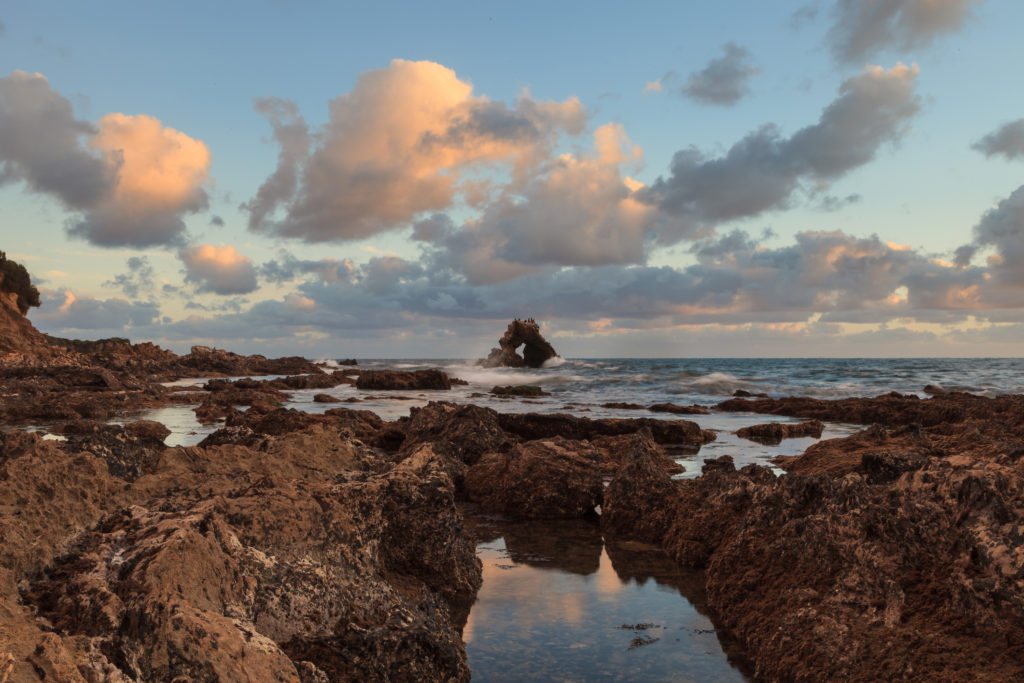
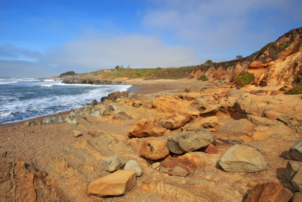
5. Point Buchon, San Luis Obispo County, California
Michael L. Bird/Getty Images
Decades of hikers at Montaña de Oro State Park have reached a fence at the park’s southern end and gazed longingly at the unspoiled California coast just beyond it. Now a 3-mile loop trail has opened on this Pacific Gas and Electric Company property, with access to secluded Coon Creek Beach.
How to get there: In Montaña de Oro State Park, follow Pecho Rd. to its southern end. —Matthew Jaffe
6. Leigh Lake, Teton County, Wyoming
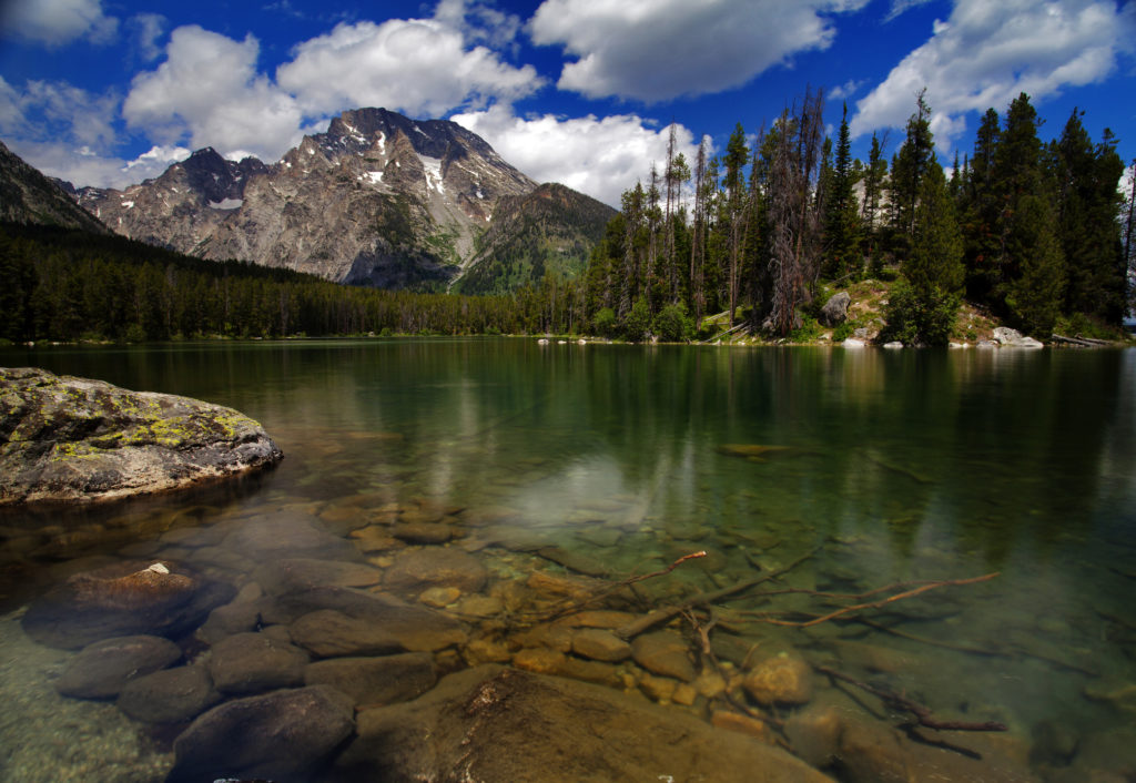
Priyanka Haldar Photography/Getty Images
For a strangely tropical setting beneath the Tetons, canoe, or kayak north up String Lake until a short portage brings you through the forest to Leigh Lake. On Leigh, bypass the first island you come to and head north about a half-mile, to where a peninsula on the western shore juts out to form a tiny beach. (There’s a campground nearby too.)
How to get there: From the Grand Teton National Park entrance at Moose, take Teton Park Rd. 10 miles north, turn left at N. Jenny Lake Rd. for about a half-mile, then follow signs to the String Lake trailhead; gtlc.com. —Amanda Gersh
7. Mahai’ula Beach, Big Island, Hawaii
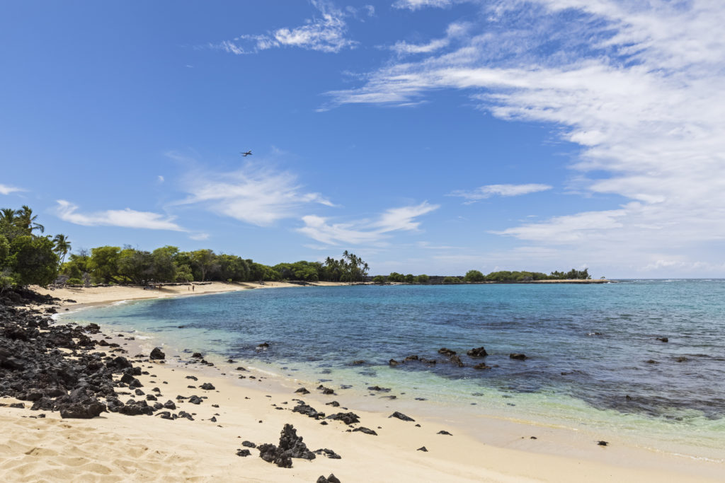
Westend61/Getty Images
An oasis of brilliant sand set amid miles and miles of ebony lava fields, the beach appears to have been dropped in the middle of nowhere. Its westward orientation delivers some of the best sunsets on the Big Island, and its out-of-sight location 1½ miles off the main highway keeps away the tourists.
How to get there: Look for a sign reading Kekaha Kai State Park about 2½ miles north of Kona International Airport, off State 19, marking the entrance to the unpaved beach access road. —Alex Salkever
8. Bean Hollow State Beach, San Mateo County, California
Sgoodwin4813/Getty Images
Hidden off State 1 along the San Mateo County coast, Bean Hollow is famous for sandy beaches and tidepools with orange-lavender seastars and purple shore crabs. It’s also a favorite spot for beachgoers―after big storms, it has been known to turn up glass floats that come all the way from Japan. For more discoveries, follow the self-guided nature trail.
How to get there: 17½ miles south of Half Moon Bay and 2¼ miles south of Pescadero on State 1. —Matt Villano
9. Sandcut Beach, Sooke, B.C.
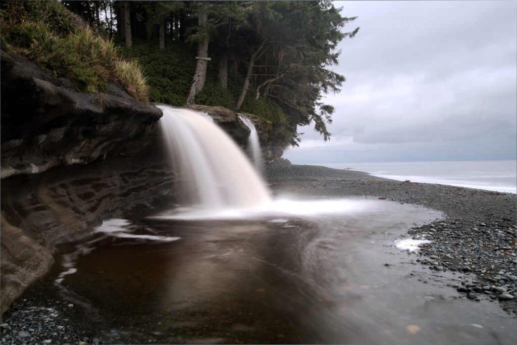
Poemnist/Getty Images
A creek spills onto the beach in a misty waterfall, tidal pools carved in sandstone teem with life, and the pebbles are as smooth as eggs. Get an unexpected reflexology foot massage as you walk on stones warmed by the sun.
How to get there: 30 miles northwest of Victoria, B.C., on Pacific Marine Route/Hwy. 14. Due to development in the area, the future of public access may be in doubt; call the Sooke Information Centre for more information. —Beverley Sinclair
10. Bowling Ball Beach, Mendocino, California
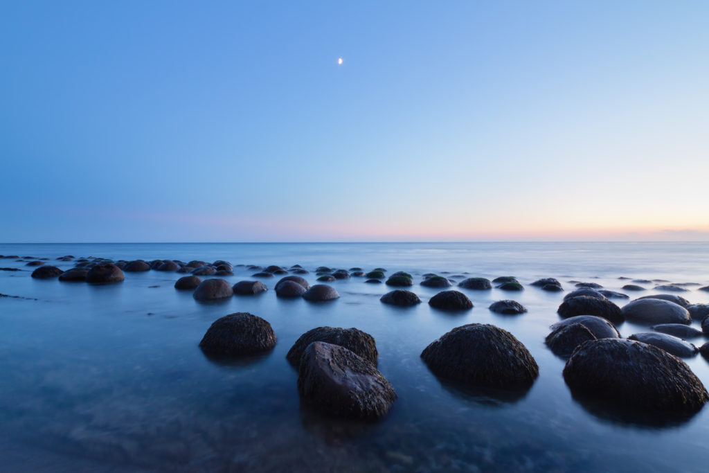
Sumiko Scott/Getty Images
Don’t let the closed trail sign deter you from visiting the southern Mendocino Coast’s most unusual beach. Just beyond an incredible temporary driftwood fort built by some beachgoer and a few hundred yards to the north, extreme low tide reveals dozens of large, round sandstone boulders. Very few people scramble down the ladder to the beach to check out this unusual natural phenomenon, and that’s just the way we like it.
How to get there: On State 1, 3 miles south of Point Arena, just north of the Schooner Creek Bridge at milepost 11.3 (take the northern trail from the turnout); californiabeaches.com —Abigail Peterson